XCguide
Fly FAR . FLY TOGETHER 

The essential paragliding app for guiding, tracking and retrieves

Reviews from Professional Guides . . .

The one app that does it all.

XC Guide is designed to help XC pilots and retrieve drivers follow their group using various live tracking systems. The app includes flight data, navigation, airspace and weather information. XC Guide works on most android phones and only requires a GPS and mobile data service or wifi

Choose your Paragliding Role

Guiding Groups
Manage your entire group of pilots on one device, no matter which tracking technology they use. Get updates of their relative height and distance from you, and keep an eye on any messages they send for assistance.
Flying with Mates
The ability of XC guide to connect with a large number of external devices and sensors is amazing. It supports FANET and FLARM. It can see and be seen by additional pilots/aircrafts from a wide range of tracking networks through your internet. 
Driving Retrieves
See and manage all pilots on one retrieve tablet that can be installed in the vehicle. Prioritize listing views based on SOS texts, pilots needing retrieve and those who are still flying.

Collate & Track Data from Multiple Sources

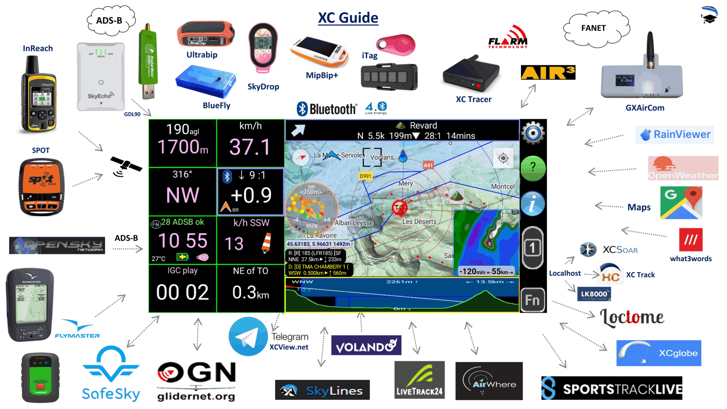
XC Guide helps pilots and retrieve drivers track each other using these sources:
Open Glider Network (OGN), FANET, FLARM®, SkyLines, Telegram, FlyMaster®, Livetrack24,
Garmin inReach®, SPOT®, AirWhereXC Globe, Loctome
SportsTrackLiveVolandoo and SafeSky

General Aviation traffic using ADS-B can be tracked when XC Guide is linked to a SkyEcho2 ADS-B transceiver
or via the internet using the OpenSky® provider. 
xc guide

Guiding . Strategy . Retrieves

The one app that does it all

Track pilots in the air from your flight deck

XCguide

Flight Computer

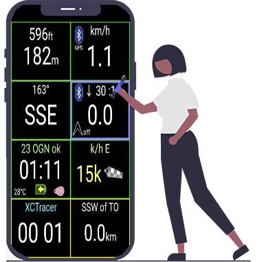
The Flight Computer indicates altitude, ground speed, bearing, climb/sink rate, glide angle, wind direction, time, flight duration and distance from takeoff. 


Barometric pressure and climb rate can be obtained either from an internal sensor or via Bluetooth using an XC-Tracer, BlueFly vario or MipBip+ vario

Your altitude above ground level (AGL) can also be shown. The terrain height above the WGS84 geoid is obtained from HGT files. 


These are downloaded automatically from the repository at PG-Race.aero/agl and are saved in /Android/data/indysoft.xc_guide/files/Terrain/ 

XCguide

Live Maps

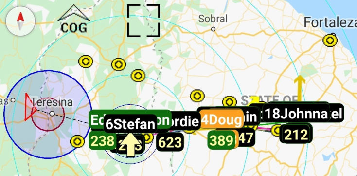
The map shows other pilots, retrieve buses, airspace, way-points, thermal hot-spots and flight trails. 

Live Maps

Pilot List

The Pilot list shows each pilot's glider, their location and altitude relative to you, their tracker type and status messages. Contacts permission is only requested if the integrated contact features are used.
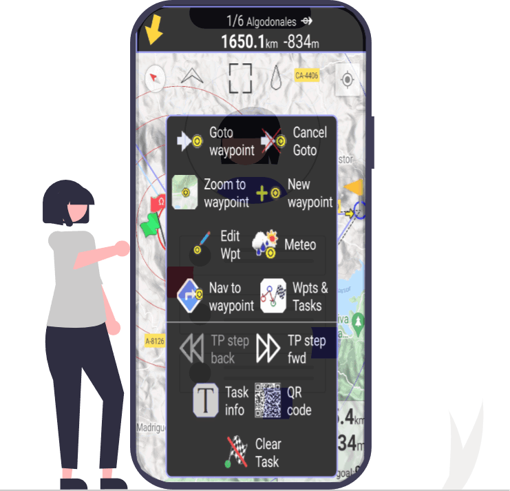
Tools to plan and fly the optimum route

Thermal

Navigation, Waypoints and Tasks

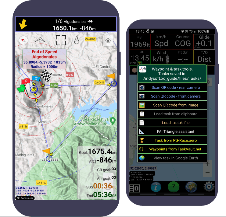
The Navigation tool manages waypoints and tasks. The create can waypoints easily. They can also import waypoint files and tasks from TaskVault.net

waypoints

Thermal Assistant

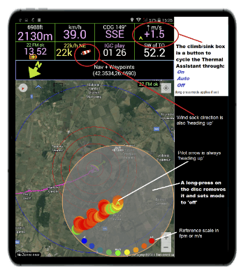
The Thermal Assistant displays an evolving colour coded map of thermal strength around you, which helps you centre in the core.

Thermal hotspots are shown on the map as red dots. 

Hotspot files in .CSV format can be downloaded from: http://thermal.kk7.ch

Competition task

Competition tasks

The PG-Race.aero service has been provided to design, edit, share, activate and automatically score Competition Tasks. XC Guide and PG-Race have been designed to work together and complement each other.

Tasks are fully compatible with FlySkyHi and XCTrack.

Camera permission is only requested when scanning QR codes, for easy task sharing. 

Monitor airspace, weather reports and rain

Rain Radar

Rain Radar

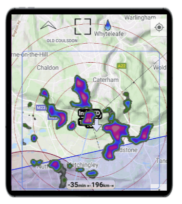
A rain radar widget from RainViewer can also be overlaid on the map.

FANET

FANET

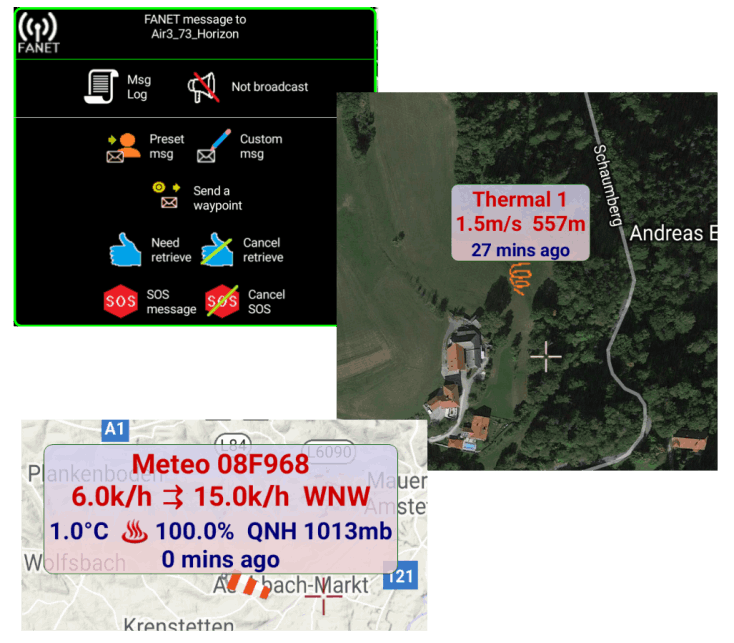
FANET is fully supported by XC Guide, with text-messaging, SOS & Retrieve alarms. FANET weather reports and shared thermals appear on the map automatically. 

FANET requires an Air3 7.3+ tablet or a LILYGO or Heltec 868MHz LoRa module with GxAirCom firmware. 

Airspace

Airspace

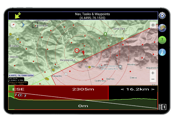
Airspace files in OpenAir format can be shown in plan view on the 2D map and in cross-section. It can also be exported in KML format to GoogleEarth for 3D visualisation.

XC Guide

Audible Warnings & Alerts

Audible warnings alert you to 'SOS' and 'Need Retrieve' messages, airspace proximity, FLARM ® collision warnings and new FANET messages.

Flight Logs

Flights are logged as IGC and KML files. Flight logs can be replayed and shared. IGC files from XC Guide are accepted by FAI/CIVL and verified by the online validation service. They are also accepted by XContest and SportsTrackLive. 

Stay connected to your group

XC Guide can automatically send an email to your safety contacts when you take off and land. 

Download

Latest App Version

Install XC Guide from Google Play Store

XC Guide Privacy Policy     |     © Copyright 2021-2023 XC GUIDE :: All Rights Reserved :: V10   |    Web Design by Sky Studio